Portugal: Air Force buys radar satellite
Lisbon: The Portuguese Air Force has acquired a satellite that captures high-resolution images that can be used to predict meteorological phenomena and natural disasters or assist in search and rescue missions, in addition to other military purposes.
The agreement was formalised in Monsanto, Lisbon, and signed between the Aerospace Technology and Innovation Center (CTI) – which consists of a partnership between the Air Force, the engineering center CEiiA and GEOSAT – and the company ICEYE.
The issue at hand is the acquisition, through resources from the Recovery and Resilience Plan (RRP), of a synthetic aperture radar (SAR) satellite, which allows the capture of high and very high resolution images under any weather conditions, a ground segment and an antenna.
A memorandum of understanding was also signed for the exchange of knowledge between entities that will allow Portugal, through the Air Force, business and academic sectors, to build its own satellites in the future. This investment is part of the launch of the so-called “Atlantic Constellation”, a joint project between Portugal and Spain to develop and launch a constellation of Earth observation satellites.
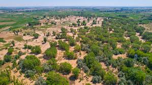
The goal is to reach 26 satellites, 12 of the SAR type and 14 optical, according to information provided to Lusa by the Air Force. This satellite can be used by the Air Force to support images in surveillance and intelligence actions, in search and rescue, or in the collection of data on maritime pollution.
It can also be used to predict meteorological phenomena and natural disasters and to support civilian areas such as agriculture, in addition to the more common military purposes (the war in Ukraine has used several satellite images, for example). An official source in the sector also highlighted to Lusa that this type of investment also allows “retaining talent” in the country, avoiding the “brain drain to other countries”.