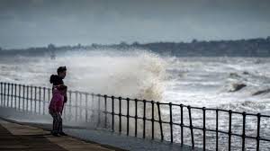
Could Hurricane Erin bring wet and windy weather to the UK?

London: Hurricane Erin will eventually track eastward in the North Atlantic towards the United Kingdom.
But crucially it will weaken and no longer be a hurricane or tropical storm before it brings the UK any impacts.
For the eastern coast of the US, Erin brings life-threatening rip currents and a storm surge over the next few days despite staying out in the open waters of the western Atlantic.
Ex-hurricanes and their remnants bringing wet and windy weather to the UK is quite typical from mid- to late August, as the hurricane season starts heading towards peak activity.
By Tuesday the remnants of ex-Hurricane Erin are still in the mid-Atlantic as an area of low pressure, though uncertainty remains on its track later in the week
While still a hurricane the outer reaches of Erin will result in strong winds and dangerous coasts along the eastern seaboard of the US this week.
Over the weekend, however, it will track north-eastwards away from the US and by Monday is likely be downgraded to a tropical storm.
As it continues its projected path towards the UK, it will decay even further and lose all its “tropical” characteristics, becoming what meteorologists call “extra-tropical”.
Or in more simple terms, it will be a deep area of low pressure containing the remnants of what will be ex-Hurricane Erin.
Weather forecast models sometimes struggle with these tropical remnants so the track ex-Erin takes from the middle of the week is still uncertain.
Different models are coming up with varying solutions and the forecast is therefore more uncertain than normal.
What is very likely, however, is that our weather will become more unsettled with wet and perhaps windy conditions at times during the second half of next week.
Map of the Atlantic Ocean showing sea surface temperatures with southern areas red and purple, indicative of temperatures above 27 C. Green and yellow colours in the North Atlantic closer to the UK indicative of sea surface temperatures below 20C.
Hurricanes need a few atmospheric ingredients to come together to form: a disturbence in atmosphere, sea surface temperatures above 27C, and little changes in wind through the atmosphere.
And it is the warm waters of the Gulf of Mexico, the Caribbean and southern parts of the North Atlantic that can really fuel and supercharge storms to become big hurricanes.
The tropical storms and hurricanes will occasionally affect the Carribean and eastern seaboard of the US before moving east back out into the North Atlantic.
For a while these can often be sustained as hurricanes due to the warm waters.
But eventually, as they move further north and east, the Atlantic gets cooler – 16 to 20C in mid-August – cutting off the energy needed to sustain a tropical storm or hurricane.
This is the reason why the UK will never be affected by a proper hurricane.
Ex-hurricanes heading our way can often conjure up wild headlines and speculation.
But in reality the weather that the UK may end up getting is no different to the occasional stormy weather we can sometimes see in autumn and winter.
Strong winds and heavy rain are part of that.
The most noteable ex-hurricane to impact the UK and Ireland was Ophelia in October 2017.
Moving up the west coast of Ireand, strong winds resulted in power cuts and travel disruption in western parts of the UK.
With a southerly airlfow linked to it, Saharan dust and smoke from Portuguese wildfires was also transported to the UK, resulting in eerie red skies.
The Atlantic hurricane season runs from 1 June to 30 November but most tropical storm or hurricane activity occurs from mid-August to mid-October.
So as we enter this period, there is a greater chance these could end up coming across the North Atlantic towards the UK.


